Friday 29 November 2013

A day off the bikes in Snug


All of us slept till late this morning - 0900, which when you consider that we’re usually up and about by 0700 at the latest, is a bit of a sleep in. But it was pouring down again, so it didn’t matter as we had already decided that if the weather was pants, we would do the laundry, tinker with the bikes and generally have a day in the dry.

And pants it was, bright sunshine interspersed with black clouds and downpours. No wonder they have such green grass down here.


So after chucking the dirty washing in the machine, Nadine and I spent an hour or so looking at routes for when we’re back on the mainland, scoping out dirt roads instead of main highways that we could take between places, and finding stockists of suitable front tyres. We don’t need to replace them quite yet, but we will when we start to move west after Christmas, particularly if we follow our gravel road plan. We could ride Australia along the main roads but as this is one place where unsealed routes are everywhere, we have a prime opportunity to use them. Riding from town to town on tarmac is not really what we want to do, anymore than planning each night or knowing where we’re going to sleep.  It sort of kills the wandering aspect of a trip like this.

Gordon did a bit of tinkering with his bike, ringing the  spokes, all of which were fine, before cleaning and lubing all of the chains. We need to buy some oil tomorrow and then do three changes, but its not urgent.


The rack mod on my bike works well; I just unbolt it when we stop for any length of time and leave the leg scything and car denting bottoms at home. Easy, and I don’t really understand why the racks were built as they were in the first place.


Just up the street from where we are staying is a sign to ‘67 Black Tuesday’. Its a proper street sign thing, but neither google nor wiki knew anything about it. 


But then in a break between rainstorms, we took a walk along the beach and stumbled across what it is all about.


It relates to a day in February 1967 and the worst bush fires ever in Tasmania, and Snug was caught up in them. The whole coast seems to have been in their path, with Margate just up the coast a bit saved. But the residents of Snug had a hard time and most took refuge on the beach, standing in the water whilst the worst passed, but 62 people locally, 11 in Snug, as well as many properties were lost. A sad story.

The little memorial garden down by the beach tells what happens, including the ironic fact that the Chief Fire Officer was called Crisp. And the area has been planted with fire resistant plants, one of which is called Pig Face.

The beach is really small and its hard to envisage how so many people crammed onto it, but they did.


There are some very noisy Plovers nesting just out the back of where  our cabin is. They’ve got four eggs in the grass and defend them quite viciously should anybody wander too close. 


But how silly are they? They sit in the grass, no nest as such, nor any protection for their eggs, so people step on them. Get a tree house and use your wings you soppy Plover birds.

To Snug


What a daft name for a town but that was our destination today. Snug. Just south of Hobart and on the coast, it was a 180 kms from where we had stopped on Lake Pedder last night.

It must be great to be the person who invents a town, as you get to call it what you like because there is nobody there to argue. And anybody who doesn't like it has to go and live elsewhere. But Snug. WTF? Who thought that one up? Why not call it Buggeroffville or Mytownmyrules or something? 

I found out the other day that Melbourne was known for a short time as Batmania, after a bloke called John Batman built a house on a hill there and began the town. Now that is a really good one - Batmania. But it got renamed Melbourne after Lord Melbourne, Queen Victoria's mentor when she first came to the throne. Personally though, I'd rather have been mentored by Batman.

It piddled down during the night, really heavy fat rain that kept waking all of us up, but all of us stayed dry. It stopped at first light though, really peculiar as it turned off like a tap. And it stayed dry for a good few hours. Laurel and Brian turned up again to see if we were OK as the rain had woken them too.

The descent down from Strathgordon was very different from the climb up yesterday. It was dark and quite cold, with big clouds rolling off the hills, but it got warmer the lower we got. 


We reached Westerway at the bottom just in time as fuel was running low. Whilst we were in the roadhouse there, looking at the mural, the heavens opened again and more water fell from the sky. 


We stayed put for about 90 minutes but left with our wet weather gear on which was a good call as it came back not much further down the road.

A place called Plenty, en route to new Norfolk has salmon hatchery ponds which are the oldest in Australasia, whilst Bushy Park, just down the river is the hop growing capital of Tasmania, although as we discovered yesterday, nowhere near as many are grown as in years gone by.


The ride from thereon to Hobart was very blustery, with sidewinds alternating with headwinds, slowing our progress. But we kept going, made it through Hobart in the ever present rain, and found a cabin to stay in at Snug. The lady took pity on us and gave us a good deal, and a cabin with a car port so that the bikes have a bit of shelter, which will also make things a bit easier for us when we come to do maintenance in the next few days. But she doesnt know about the tinkering plans - yet.

We’ll need to do another oil change as we’ve done about 1600 kms since the last one, the spokes need checking as we have done quite a bit of gravel and unsealed road, and Nadine’s bike has a bit of a stutter when she accelerates. It might be another air intake quirk, and its not serious but we will sort it here while we can and while we have a place to work on it.


Thursday 28 November 2013

Lake Pedder and Strathgordon

I’m getting bored now writing about how great the roads are in Tasmania. But they really are, and they just get better and better. But I’m not going to mention them again. Much.

There are various references here to Van Diemen’s Land, an alternative name for Tasmania, but nobody seems to know for sure why or when the place became Tasmania. But the nearest we can find is that Able Tasman (who by the way, had the excellent middle name of Janszoon!) named it Van Diemen’s land after his boss, Anthony Van Diemen, in a shrewd bit of career posturing. Then it seems that in the early 1800s, the Tasmania name crept in and gradually took over, the first print reference being in a map in 1808 ( by London mapmakers, Laurie and Whittle ) being formerly adopted as the state name on January 1st, 1856, having been agreed by Queen Victoria a few months earlier. Apparently the name change was welcomed as by then, transportation had stopped and Van Deimen’s land was associated with convicts, so the name change gave it a clean sheet as it were.    

So what did we do today? We actually got up and going quite quickly but stopped not many kilometres up the road at Ellendale - which used to be called Montos Marsh - because we needed some bread. But the little general store which was also a Post office and a cafe did coffee and raisin toast and the bloke was very nice and chatty and we ended up having a second breakfast there for the next hour. And Santa was walking up the street in his shorts.


But again, that chatting to people business is how you find out about the places you’re riding through. Just before the store, both Gordon and I had noticed a huge structure in a field that looked like a french chateau, except that in that most Australian of Australian building materials, it was made of corrugated tin. Whilst I wouldn’t have put it past somebody to have had a crack at reproducing something normally found in the Loire Valley, this had to be something else. But what? Charlie in the store knew; it was an oast barn, (oast house) for drying hops. There were originally two but the other burnt down a couple of years ago. It was a bit bigger than the chateau shed and in its day, was the largest hop drying barn in the southern hemisphere. But not that many hops are produced round here now, so its now a drink and drug rehab centre, presumably for outsiders as there are only 500 inhabitants of Ellendale, and that includes the surrounding countryside, so even if they were all addicts who’d seen the light, they’d still be rattling around in it.  

The road up to Strathgordon is a dead end, the way in is also the way out but it passes through Mount Field national Park and the Russell Falls, which Charlie in the Ellendale Post Office/cafe/general store had said was worth a look.  

The falls were a short walk through the rainforest and past those fern things that look like mad green feather dusters, bits of which are apparently good to eat and have medicinal uses, and more massive and dead straight Swamp Gum trees. 


This variety of gum (Eucalyptus regnant) is the tallest flowering plant in the world  but it doesn’t even start the flower thing until it reaches 75 years of age.


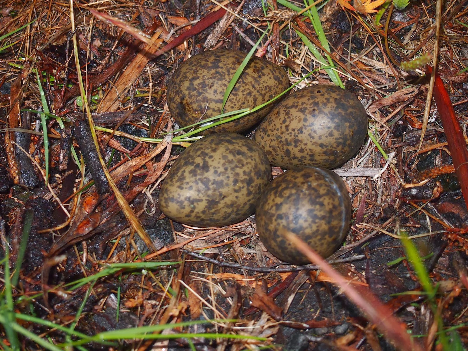
Little signs along the walk give snippets of relevant information as you walk, which is quite cool because the facts are things that you probably wouldn’t pick up otherwise. Things like there are no Koalas in Tasmania, and that their nearest relative is the wombat. Or that Kookaburras are not native either but were brought over from mainland Australia to prevent their decline. However, having arrived in 1898, they became very partial to some native flies and scoffed most of them before anybody realised, which caused a problem for fish in the streams which also relied on them and suddenly had nothing to eat. Bummer.

The falls were every bit as good as Charlie said they were, proper falls of a decent height, complete with a tree growing in the middle. 


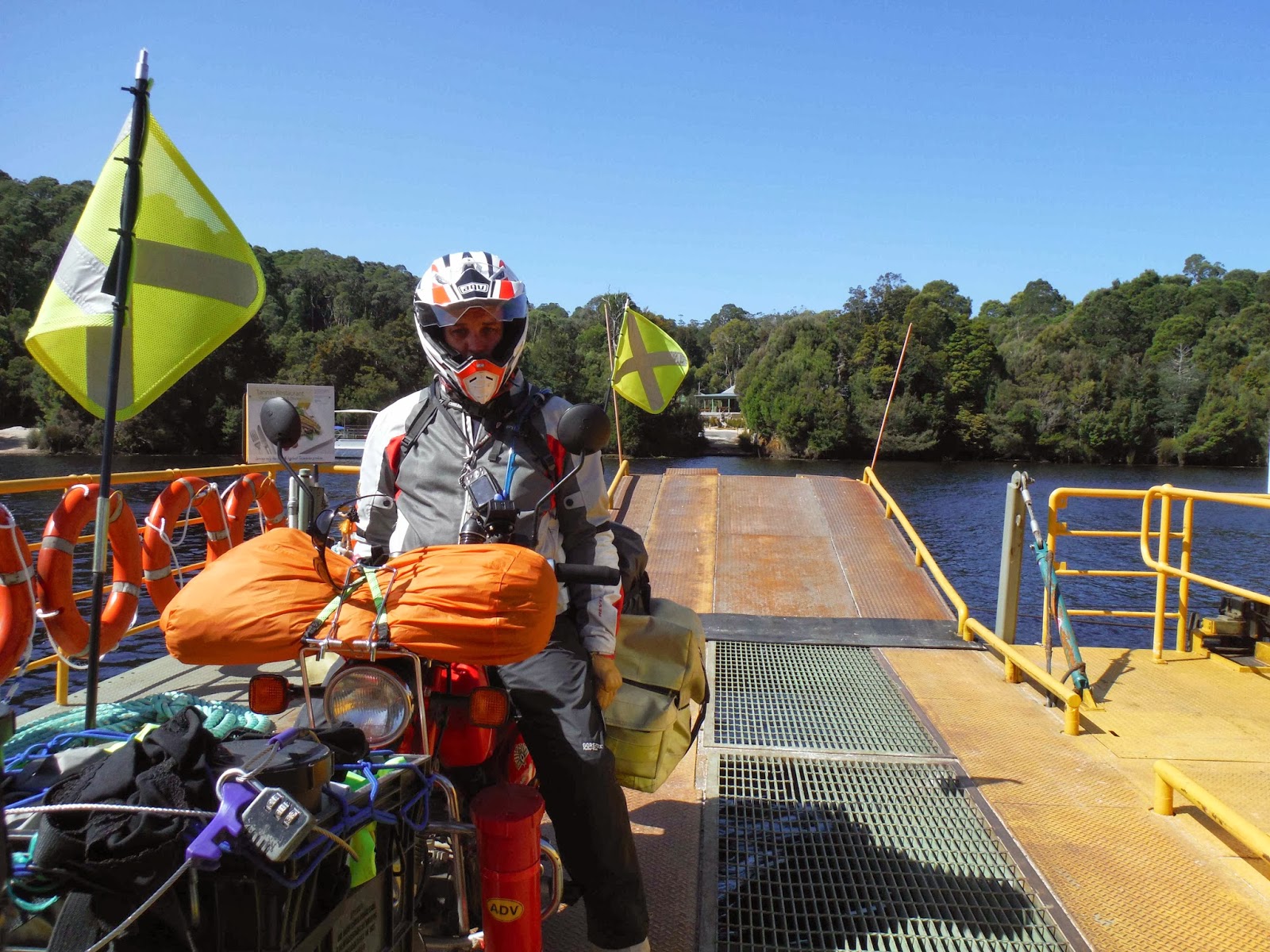
We finally reached Strathgordon, high up on Lake Pedder, and in the  Tasmanian Wilderness area, in late afternoon. 


The road was built in the late 1960s in order to get building materials there to build the Gordon Dam, part of the Mid Gordon HEP project.  And of course, the constructors needed a place to live, so they built  Strathgordon, a full  blown town with a school, shops, houses and all of the things you find in towns. And because of the rubbish weather, the school boasted Australia’s only underground heated playground.  And when the sun shone, which it doesn’t always do in Tasmania, the sunlight reflected off the quartzite gravel so brightly that the company issued all residents with sunglasses.

It’s a ghost town now, an outdoor tourist haven for walkers, complete with chalets, but 40 years ago the dam flooded the man enhanced valley below and incorporated Lake Pedder to create a huge fresh water reservoir, 27 times the size of Sydney Harbour, some 14,700 million cubic metres of water, and we all know that Sydney harbour is the largest natural harbour in the world, the second largest being Poole Harbour in Dorset, UK.


The story of Lake Pedder is interesting as it changed the way people think about the environment. The original Lake Pedder was apparently a gem of a lake, really beautiful, but accessible only to hardy hill walkers as it was deep in the wilderness. But attitudes were different then, and the government of the time homed in on Lake Pedder and its immediate surroundings as being suitable to flood as it was remote and an ideal place for the HEP plant. However, some people were against it although it went ahead, but it narked them sufficiently so that when the next major project came about - the damming of the Franklin Gordon rivers - organised environmental protest was swift and eventually, halted what would have changed both the Franklin and Gordon Rivers and the surrounding wilderness, for ever. 

The dam is impressive, possibly more so too because you can climb down to it and walk over it, quite legitimately, and there is nobody to tell you that you can't. Its a very skinny dam, 140m high, 192m long, the tallest dam in Tasmania and the fifth tallest in Australia.  Its strength is in its shape and its double curve design, being curved side to side and top to bottom, the top overhanging the bottom by several metres. Its an arch dam, the weight of the water being transferred by dispersement to the rock walls and the dam abutments, like how water would curve around the pointy end of an egg. That makes it very strong but thinner and so cheaper to build.

It did look like something out of a WW2 film set or a Bond movie though, complete with metal steps for baddies to be thrown off and a path along the top for heroes to dive from     ( and survive of course)


We met  Brian and Laurel just before we went up there. They are  travelling in a camper van and apparently keep seeing us wherever they go. They’ve been travelling for 20 years although now at the age of 85 and 80 respectively they no longer sleep in tents because they like ‘proper’ beds. They were  great but quite sheepish when they tmentioned the camper, but in the next breath revealed that they drove the Strezlecki and Oodnadatta tracks a few months ago. They are two tracks in the outback, known for their remoteness and roughness, so they remained very cool in our opinions. 

We’re camping right on the Lake shore at Ted’s  Beach. He was the project manager for Lake Pedder and he wanted to create a beach, so he had a bit of land cleared. However, it was nowhere near any water at the time and nobody could understand it. But of course, he knew exactly where the water level would reach, and his bit of land is now right where he planned, on the lake shore, and there for all to use, and we’re camping on it tonight.


Hopefully, no tidal wave will occur while we’re asleep  or it could be uncomfortable, but fortunately, Nadine’s tent is nearer the water than mine, so if the unthinkable happens, her squwarks should wake me and allow me to scramble out of my tent in time to keep dry.


I had a swim in the Lake, which is very clear (apart from the tanin which is in all the water round here) and quite warm. Nadine tried a bit of fishing but failed to catch anything which was apparently my fault as I apparently must have scared the fish away. But come on;  this Lake covers over 514 square kilometers and I was only swimming in a very small bit of it, so it wasn’t my fault. She needs to take her rod back as it clearly doesn’t work.


Gordon River Cruise


We were up and out early this morning, having booked a cruise on the Gordon River first thing. 


I was woken by the birds shouting and hollering, just as it was getting light (0509hrs). The sky was beginning to turn orange, the ocean was glazed and silver, and the air was still. Priceless, and something for which there is no match; first light is a special time wherever you are, the promise of a new day.


Anyway, the cruise. The boat headed out to The Heads, the place where the Gordon River and Port Macquarie Basin meet the Ocean proper. This was a very dangerous place for the early ships because of the turbulent waters which also churned up the seabed, rendering many of the channels too shallow. And this was uncharted water too at the time, so it was a double whammy.


According to the captain, this was one of the calmest days for a few weeks so we were exceptionally lucky. The water was still, very little wind, and we zipped along at 26 knots, getting close up looks at the several islands in the Basin, as well as the fish farms located there. Its mostly salmon and Ocean trout, which are fed a very high protein diet of bait fish pellets and grow very quickly, giant super fish.


The water both in the Ocean and up the rivers looks brown and dirty but it’s not; the colour is down to the tanin which leaches out of the soil. 


And the former sea level can be seen on surrounding rock faces, a clear line having been worn thousands of years ago by waves lapping against them.


But the best sea creatures today were dolphins which appeared suddenly and swam alongside us for several minutes, keeping pace with the ship, jumping in and out of the water and generally putting on a show.


A particularly nasty former convict island is in the Basin; Sarah Island, a prison island for repeat offenders. We got off the boat here and had a good walk around.


Apparently, the island was heavily wooded but they cut down the trees when they turned it into a prison. Big mistake as there was then no shelter from the wind, which lies right in the path of the roaring forties, coming across from South America. Its bad enough in summer and spring but the winter became unbearable as a result, for staff as well as convicts. 


A part solution was to build a 12 m high fence right round the place, but that is long gone, having blown away or rotted or both. But the convicts had to live with wooden screens separating buildings in an attempt to make it slightly more survivable.

The whole of the east side of the place was built up Blue Gum was brought across from the main island lashed between two boats as it is so dense and does not float. What with Huon Pine, which is light but high in oil content, it became a ship building haven. But these had to be kept locked to a cliff to stop convicts nicking a ship and escaping, although a gang did do just that later on. For various reasons, they were left there with no supervision, expected to build a ship and then it sail it to Hobart, and go back to gaol, but instead they built it and sailed to Chile, where most of the crew gained their freedom, while four were shipped back to Van Diemans Land where they were sentenced to hang for piracy. But they argued that they had  only nicked the materials as it was not a ship when they took it ( as they were still building it) and it wasnt piracy as they werent on the high seas but still in harbour  waters. That made them guilty of felony only so they won, and were transported elsewhere and finally got their freedom.

There was an excellent play about it on the waterfront. Two actors and audience particiaption, all of us being dragged out to play various roles. Very funny, very good and and excellent way to finish off the day.

The ship  also went up the Gordon River where we had a bit of a bank walk amongst Huon Pines, Blackwood and Myrtle in the temperate rainforest. It was like a set from ‘The Land that Time Forgot’  but this was the real thing. The Huon grow very slowly, as little as 2mm in diameter per year, so they are very old. 


Those we walked through were probably 300 years old but had been left because they were either crooked or knotty, or too small, and so no good for ships timbers,when the piners found that bit of forest back in the early 1840s. 

The Huon Pines are a pecuilar tree in that they are either male or female, and grow by layering; when bits drop off the trees, they start growing again on the forest floor. Thats what helps keep the forest so dense.


The trees also have to be about 500 years old before they produce pine cones, but these are so small that you’d think they were mouse droppings.


The trees on the river bank are smaller than higher up, having been stunted by waterloged roots, and there are very few birds on the Gordon River as it is so deep; immediate fall off fro the sides means that its too deep for even waterbirds to feed off the bottom.

The place is a temperate wilderness that was nearly lost in the 1970’s if a plan to dam the Franklin and Gordon Rivers had gone ahead. The Gordon is Tasmania’s largest river by flow and the Franklin is huge too. But  Eco warriors  saved the day and it was eventually declared a world Heritage site, saved for all time, or at least until somebody changes the law. It would have made  huge difference to the area  and the eco system. The flow rate would have changed, meaning that the mix of freshwater to sea water would have changed thus upsetting the flora and fauna.


Waratah


Our boots were dryish when we set of this morning after yesterday’s soaking. But I wore my waterproof socks just incase. However, Nadine has lost hers and so was forced to improvise. Not too pretty but they did the job.


The plan was to ride to Strahan on the west coast but to do this, we had to go up and over some mountains. It was bright but cold, and the temperature dropped considerably as we pottered along. 


Its a time like this when perhaps a little more poke would be welcome, but they are postie bikes after all, so we had to get on with it.


The landscape at the top changed into open heathland from quite dense bush on the way up. Various echidnas were doing whatever echidnas do at the side of the road as we passed. I spotted two and only realised that a third was there when the clump of grass that I happened to be looking towards, started to waddle off towards the treeline.

Warata is a town named after a shrub; a pretty bush with red flowers and thick green leaves, and are quite common amongst roadside vegetation.


But the Tasmanian plant is smaller than those that are common on mainland Australia, but have better flowers, according to the Harley rider we met in the cafe there. He’s probably right, but we were diplomatic and agreed with what he told us.


Warata used to be a mining town and was known for its mechanisation, but that is all gone now, save for a few artifacts dotted round the place. The waterfall in the centre of town is now merely a picturesque thing to look at but once had seven waterwheels powering machinery from it.


The man where we had stayed in Wynyard had drawn us a map of the ride to Waratah and suggested we stop at the cafe in town up the hill. We did that, and what a good find it was. We were freezing by the time we got there as we had ridden up and over the ridge, but this place was not only warm and very welcoming, but served excellent food. Owners Yvonne and Russell were great, entertaining us while plying us with coffee while we hogged the heaters to thaw out.  Really nice people, and we spent a great hour in there chatting and listening what to see in the area.


As we were kitting up outside, various bikers came by  and stopped for a chat.  That is always a high point of the day, swapping ride stories with other two wheeled fans.


The town used to produce osmirido an the biggest nugget of it to be found in Australia was found nearby. I’d never heard of it, but a history board nearby revealed that it was an alloy, and used in the making of gold nibs for fountain pens - Osmaroid. Remember those from school?

Yvonne and Russell plus some of the bikers we had chatted to told us that the silicon road was open nearby. This is part of the Western Exlorer gravel road which we had planned to ride down from near Woolnorth to Strahan, but were unable as most of it was closed due to a serious landslide. But they all reckoned the bit from Savage River to Corinna was open, so we decided to give it a go.

Its called the silicon road because its made out of silicon dust, the spoils of stuff mined nearby. That all goes off to Japan to make expensive lenses, but the dust has been used to make a gravel road. Its hard packed and very fine, and also very very white and the glare makes your eyes hurt. But it was an excellent ride, and it took us all the way to Corinna, just like they all said it would.


The local joke is that its probably the most expensive road in the world, given the effort that went into producing the fine grade dust, and they’re probably right. So having done the Silk Road, we’ve now done the Silicon Road!

At Corinna, which comes from the Aboriginal ' Korerrennaa' we had to cross the Arthur River, but there is no bridge, just a barge ferry called ‘The Fatman’ because it goes through the Pieman Reserve. To call it, you stand on one bank and wave and shout until the bloke operating it sees you.Then he might come and get you when he feels like it. Its a five minute ride but it is worth it. 


The road the other side had been partly paved but there was  gravel too - they’d clearly run out of silicon by the time they got here. But never mind, it was good enough and we reached Strahan just as the booking place for the river cruise was about to close. But the ladies booked us three tickets for the morning, and we left for a campground out at The Heads.  Its just out of town, down a long dirt track. A great way to end the day.


We also passed trough Zeehan this afternoon. Once the third largest town in Tasmania with a bustling high street two miles long, it is a now a quiet country town, overlooked now that the mining that created it, has gone. It had a hospital, and electric company and its own newspaper office, the town catered for over 10000 people at its peak. The theatre was the largest concert hall in Australia and some famous names played there - Dame Nellie Melba and Lola Montez.


Its always odd when you pass through these places as there are invariably buildings that were once important and focal points of the community - the Post Office, the theatre, various grand hotels - but they are no longer used. Some have changed purpose but some still retain the purpose for which they were built. It must be very odd to see a local production with the ten other people in the town seated in a place built for hundreds. But the theatre in Zeehan has been restored  and is part of a heritage project.


Just as towns such as Sheffield and Railton have created a bit of an interest point for themselves ( murals and topiary) these former urban gems have at least recognised their heritage an used it as focal points in the town centre.


In every place, there are bits of preserved machinery, history boards noting town facts or people, and little tributes to various things that have gone on in the past. 


It's nice and there is a definite sense of town pride. Things are cared for rather than trashed as they would be elsewhere.